The Best Things to Do in Death Valley: Viewpoints and Must See Stops
Death Valley is easily one of the most otherworldly places I’ve visited. I went expecting endless salt flats and scorching desert heat. You know what I’m talking about. The classic Death Valley imagery you see in photos. But instead, I found so much more! A rare lake shimmering under colorful mountains, tall sand dunes that felt like I’d just landed on a planet in a galaxy far, far away, and golden canyons that twisted and turned with rocks speckled in pink and blue-gray.
If you’re planning your own Death Valley adventure, here are the must-see viewpoints and stops that I recommend to make your own trip unforgettable.
Badwater Basin
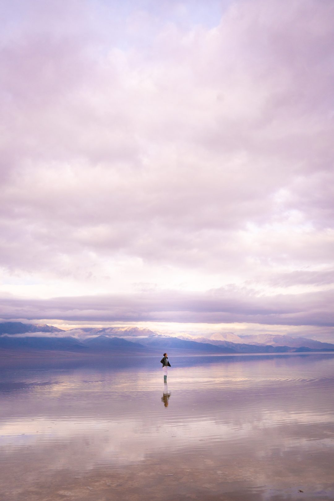
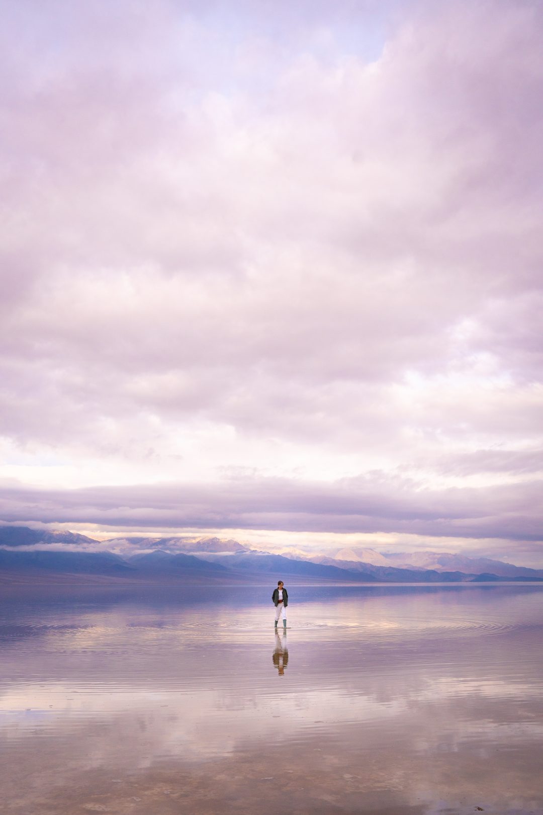
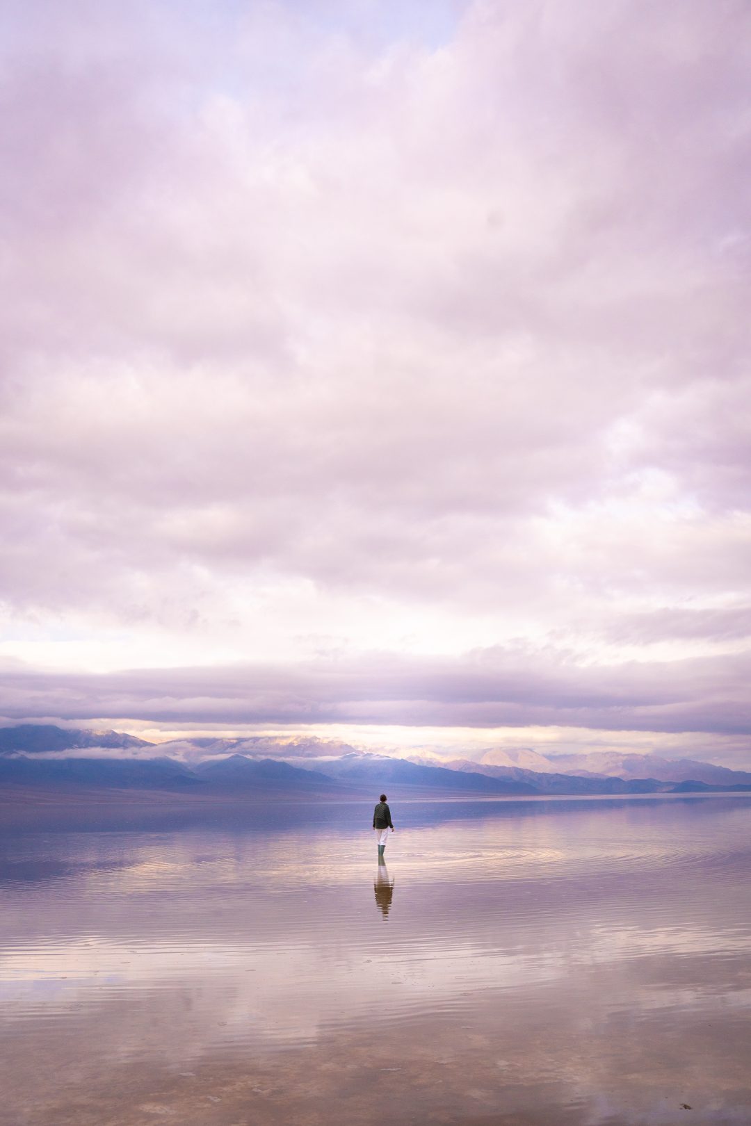
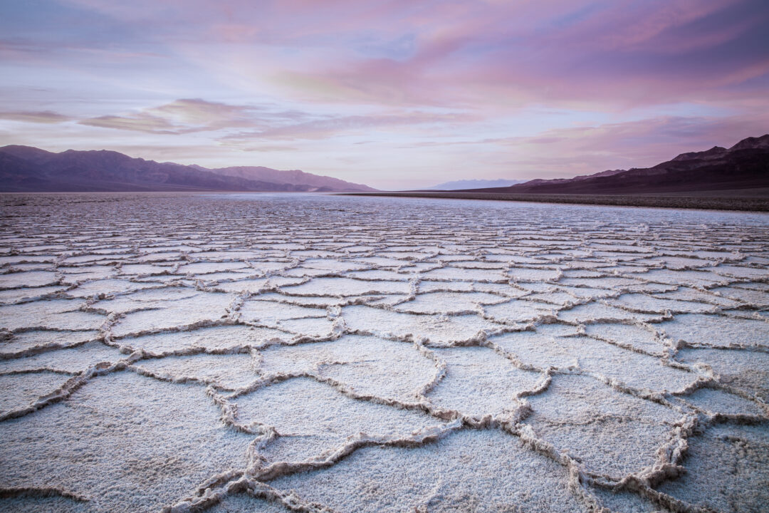
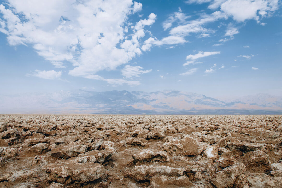
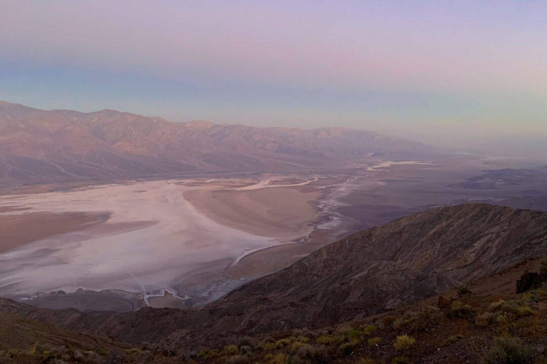
Possibly the most famous site in the national park, Badwater Basin is the spot that should be on everyone’s Death Valley itinerary, and rightfully so! Sitting at a comfortable 282 feet below sea level, it’s a vast white salt flat and the lowest point in all of North America. Here, you’ll typically naturally-occurring hexagonal patterns that form when water evaporates and leaves behind salt crystals. It’s one of Death Valley’s most iconic landscapes and stretches nearly 200 square miles across the valley floor.
I’ll be honest, I was bummed when I first arrived shortly after the New Year and found it flooded instead of covered in those iconic hexagonal salt patterns. Here’s the thing though: seeing this much water in Death Valley is incredibly rare, so much so that they even named this rare phenomenon Lake Manly, quite possibly the rarest lake in the entire world!
I’d brought rain boots (highly recommend if there’s been recent rain!), so I switched into them and walked out onto the shallow lake. You can pretty much walk the entire span of the lake if you want. The water here is only a few inches deep in most places. Seeing the colorful mountains of the Black Range reflected on the water’s surface was absolutely beautiful, and even though we missed the salt flats, I’m grateful to have experience this fleeting phenomenon. I might never see it again!
On a typical dry day, you can walk out onto the salt flats from a wide, flat boardwalk trail that leads from the parking lot. Either way, flooded or dry, this spot is absolutely worth the visit.
Artist’s Palette
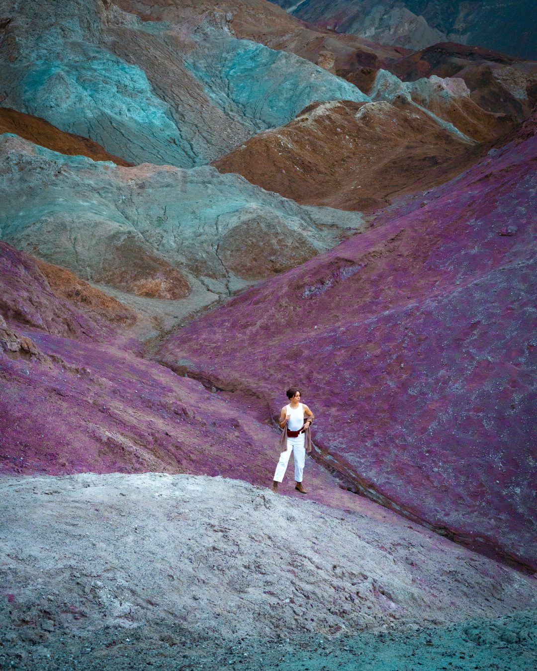
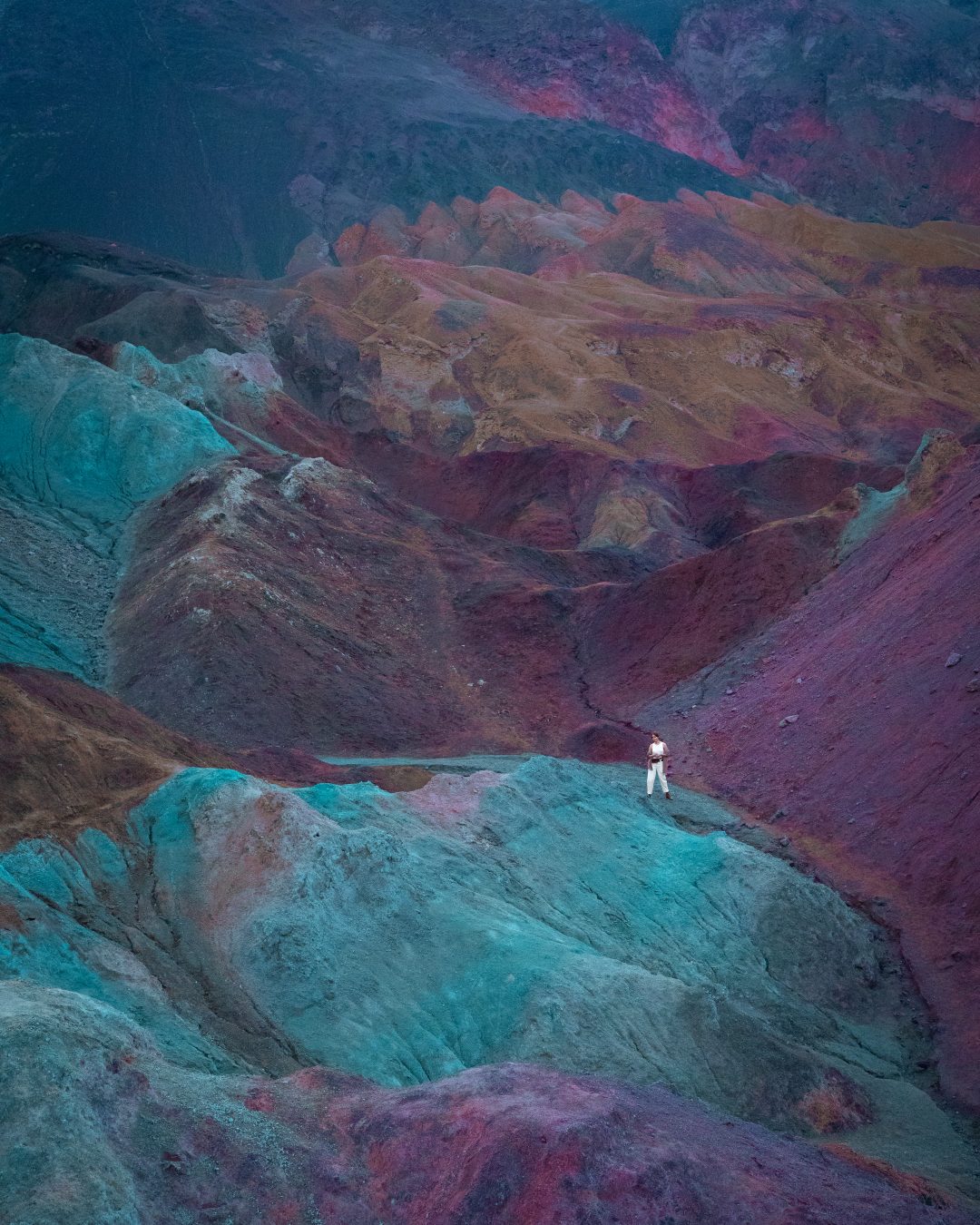
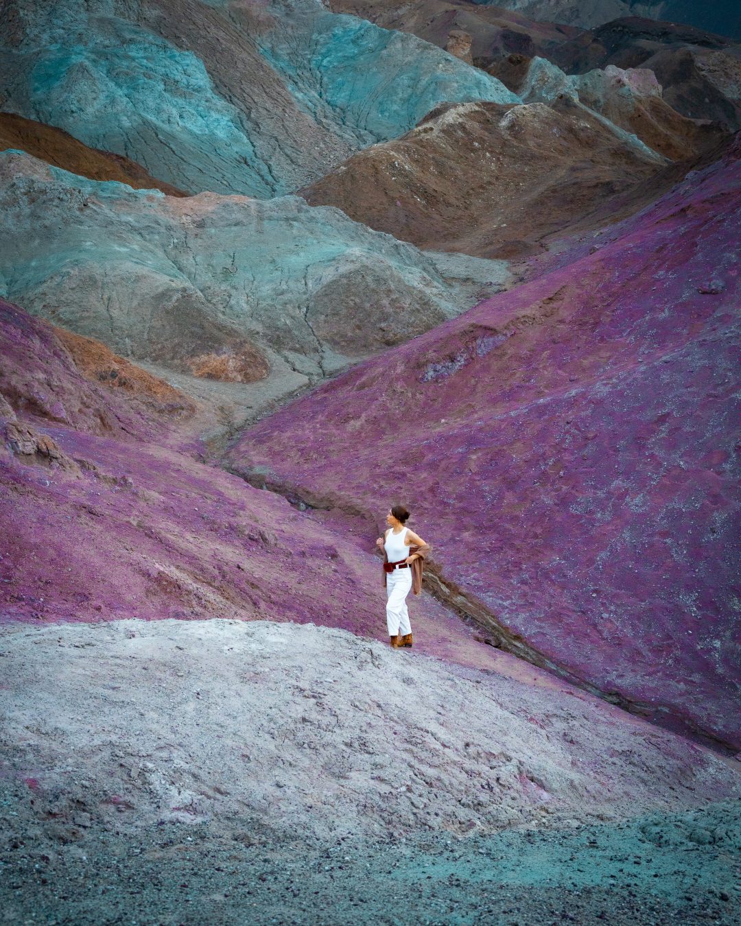
As one of Death Valley’s most photographed spots, Artist’s Palette is a hillside where oxidized metals in the volcanic rock have created vibrant streaks of pink, purple, green, and aqua. It’s located along the 9 mile one-way Artist’s Drive road, which winds through colorful badlands and narrow rock formations.
This was hands down one of my must see stops in the Valley, and I was so excited to see it that I ended up dressing up in a Padme Amidala-inspired outfit from Star Wars that morning to match this otherworldly spot. My partner and I arrived about 30 minutes before sunrise to scout the best vantage points and catch the site bathed in blue light before the desert sun would come up.
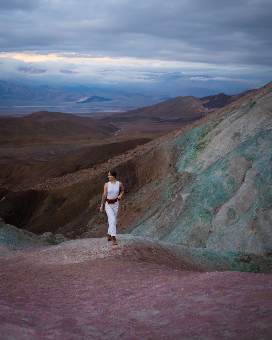
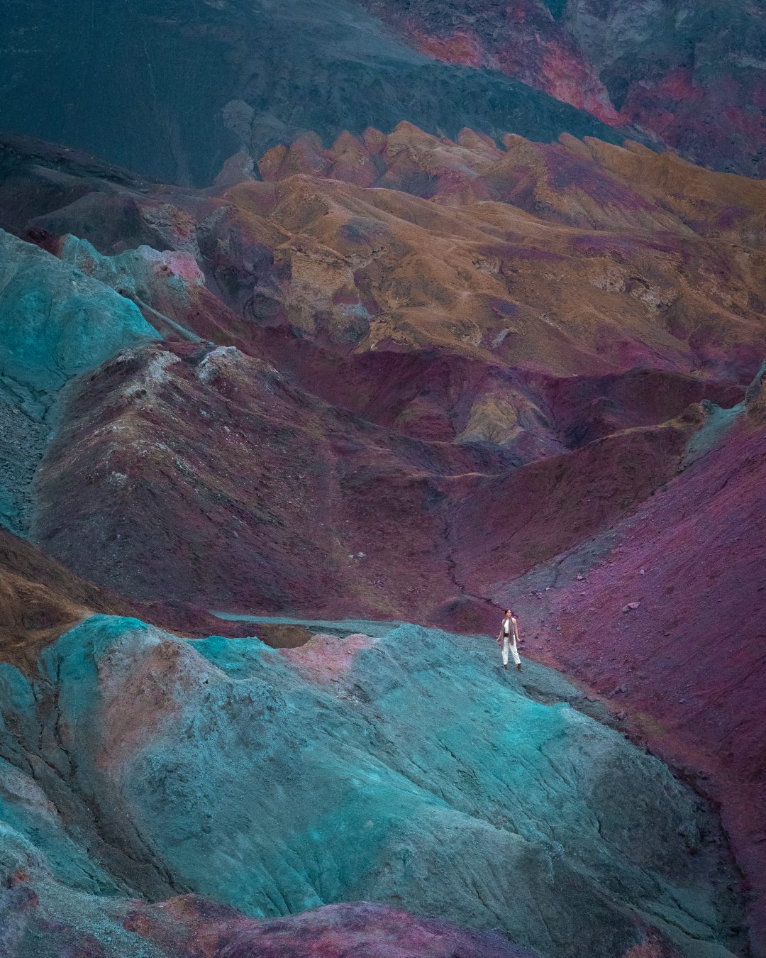
Because of Artist’s Palette’s location in the mountains, the sun was actually rising from the opposite end, which meant the colorful rocks stayed in shadow longer than you’d expect. The result? Gorgeous blues, purples, and pinks throughout the hills. There’s no real trail here, just a few stairs leading down from the parking lot into an area where you can freely explore the small canyons and climb the surrounding peaks. It’s rare to have this kind of freedom at a national park. I loved it!
Best of all? We had the place almost entirely to ourselves as most people visit in the afternoons, closer to sunset. By the time we were leaving, only four other people had shown up.
The Truth Behind Artist’s Palette
On Instagram, TikTok, and heck, even in a few of my photos above(!), Artist’s Palette is often featured with boosted saturation and vibrance, resulting in photos of what looks like a completely other planet. But in reality, take away all the Photoshop and effects and Artist’s Palette is still a completely stunning landscape. The colors here are real (just not neon) and the best time to spot them is at sunrise or sunset, when the desert sun hasn’t totally blown them out. Midday light tends to wash out the vibrant hues that make this spot so special, so timing really does matter here.
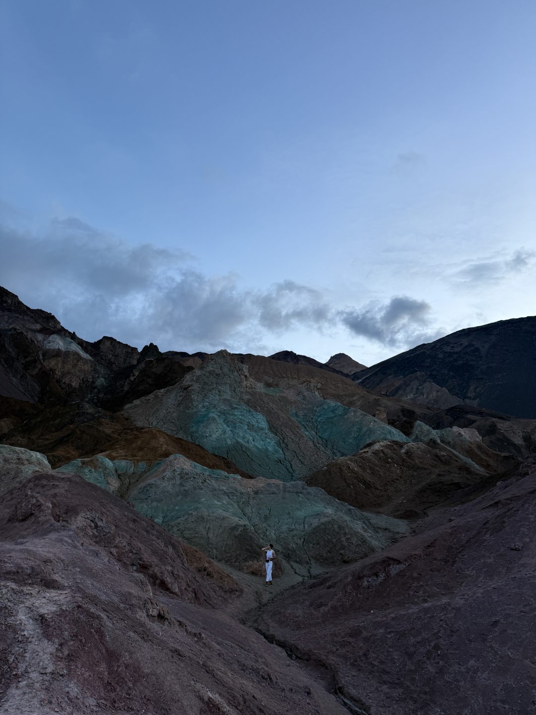
Unedited
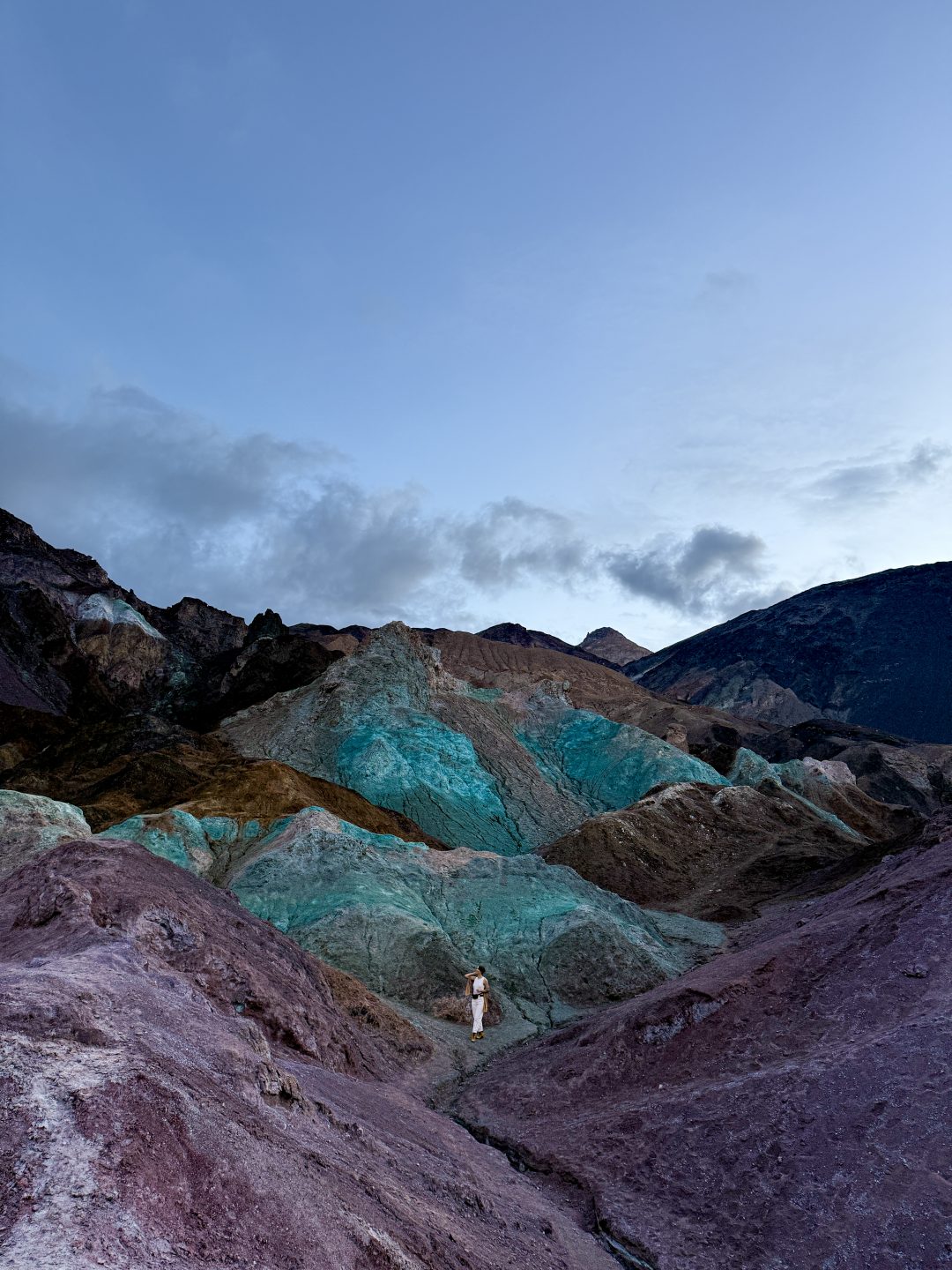
Edited
Devil’s Golf Course
Devil’s Golf Course is an area of incredibly sharp, jagged salt formations created by the expansion and contraction of salt crystals as groundwater seeps up and evaporates. The result is a vast field of salt spires and ridges.
Devil’s Golf Course was unfortunately closed during our visit because the road was flooded, but it’s definitely on my list for next time! And before I forget, the name of this spot comes from the saying that “only the devil could play golf” on such rough, serrated terrain, which is not an exaggeration. The salt crystals her are sharp enough to cut skin or clothing so definitely be careful when adventuring out here!
From what I’ve heard, you can see these dramatic formations right from the parking area without needing to hike if the road is open, making it a quick and easy stop. It’s located just off Badwater Road, not far from Badwater Basin, so it’s worth adding to your itinerary.
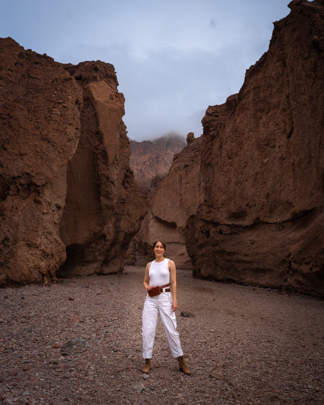
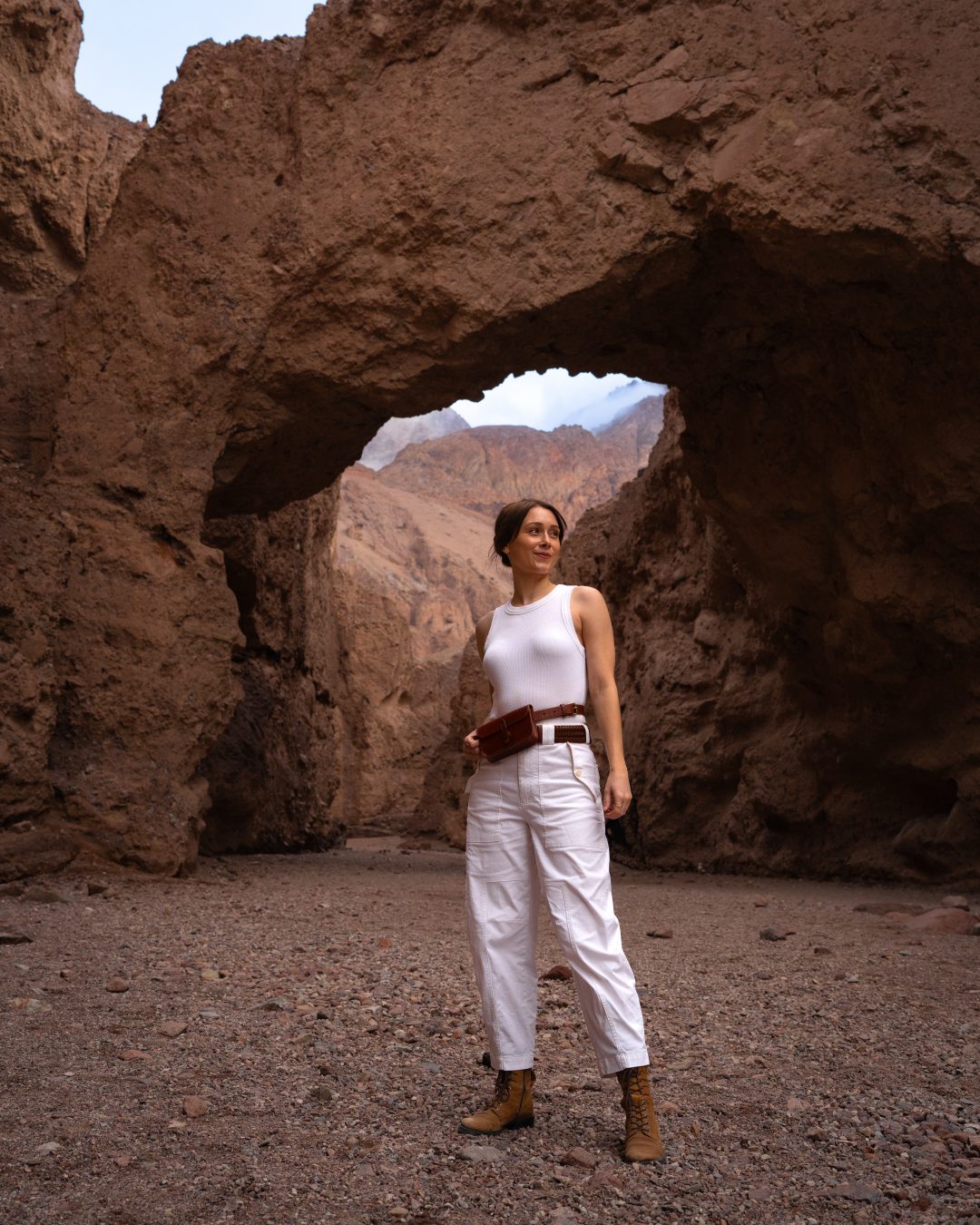
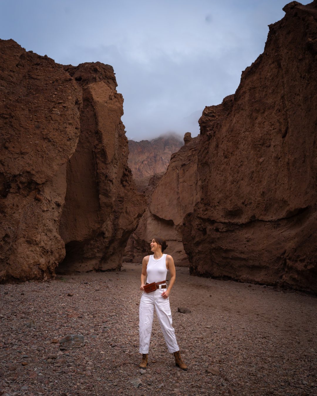
Golden Canyon
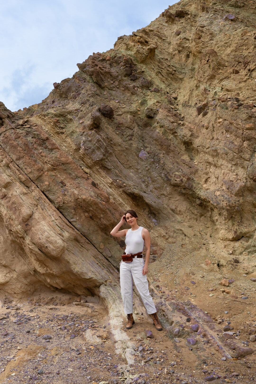
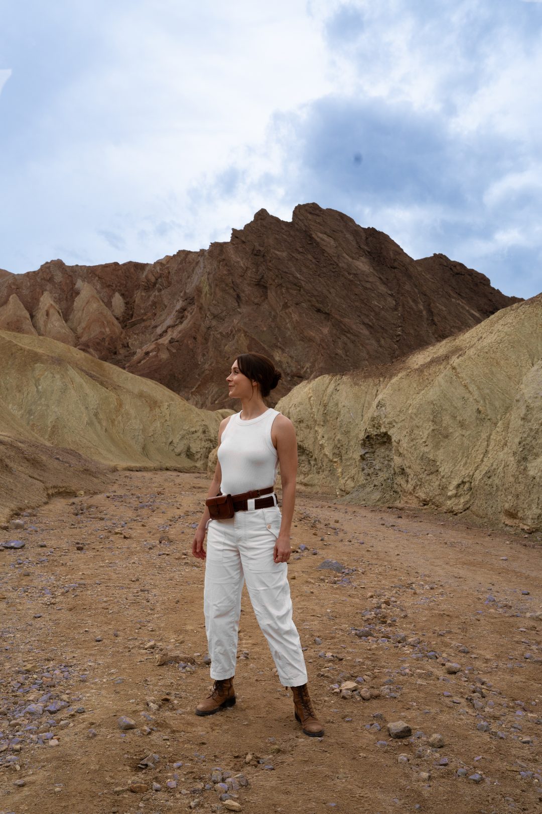
Golden Canyon is a popular hiking trail that winds through colorful badlands and narrow slot canyons. The full trail is about 3 miles round trip if you go all the way to Red Cathedral, but you can explore as much or as little as you want. There are plenty of side paths and smaller canyons to discover along the way!
My partner and I spent about two hours exploring and still didn’t make it to the end. There are so many different turns and subcanyons you can take throughout, and on a sunny day, it would be wonderful to finish the full trail. We turned around partway through because rain was forecast, and we didn’t want to risk flash flooding (a real danger in narrow canyons after storms).
The national parks app was a must-have here. We downloaded offline maps and audio guides before entering the park, and Golden Canyon’s guide was particularly helpful. There are informational markers throughout the trail that synced with the audio tour, and we learned so much about how the canyon was formed and the minerals present.
The colors here are stunning. Maybe not as vibrant as the ones at Artist’s Palette, but I liked how surprising these ones were when you found them! Layers of gold, red, purple, and even blue-gray sedimentary rock formed from ancient lake beds are scattered throughout this canyon. My two favorite moments? A cluster of purple rocks that seemed to glow in the canyon walls, and two different rocks speckled in both light pink and blue-gray. If you love geology or just appreciate natural beauty, Golden Canyon is an absolute must. Because of its explorable terrain and unique hues, the Golden Canyon is a fairly popular trail in the national park. We even spotted a guerilla film crew shooting a music video here!
The trailhead is easily accessible right off Badwater Road, and the first section of the trail is relatively flat and easy to navigate, but the later sections do have a few subcanyon offshoots that can be a little daunting to navigate without an offline map. Bring plenty of water, sunscreen, and sturdy shoes. There’s no shade along this hike.
Natural Bridge Canyon
Only about 2 miles roundtrip, Natural Bridge Canyon is a short but scenic hike that leads to a 35 foot natural rock bridge carved out by water erosion from thousands of years. The trail follows a rocky wash through a narrow canyon, and while it’s not particularly long, don’t underestimate the terrain!
My partner and I discovered quickly that this hike is rockier and slightly more difficult than it looks. The small, loose rocks made the footing a bit tricky, especially on the way back down. You’ll be sinking in slightly with every step. Not terrible, but it does make the going a bit slower than normal. Once you’ve passed under the natural rock bridge near the end of the canyon, look to the left. If you’d like, you’ll see a spot to climb up to get closer look at the top of the bridge. My partner did this after seeing a few other groups brave the climb, but I opted to stay below. It’s kind of a climb-at-your-own-risk sort of spot.
The trailhead is accessed via a 2 mile dirt road off Badwater Road, and you’ll want to wear sturdy hiking boots with good grip for this one. If you’re short on time or looking for a quick adventure between longer stops, Natural Bridge is worth the detour. Just give yourself about an hour to hike in and back!
Dante’s View
Dante’s View sits at 5,475 feet above sea level and offers sweeping panoramic views of the entire valley floor, including Badwater Basin below and the Panamint Mountains in the distance! On a clear day, you can see the highest and lowest points in the contiguous United States from this one viewpoint. The best part? You can drive right up to it.
We attempted to make the drive during a rainstorm…not our best decision! The peak was hidden within the clouds, so we didn’t see much at the top. We hung out in the car for about 10 to 15 minutes before heading back down.
On a clear day, I imagine the view is incredible! it’s consistently ranked as one of the best viewpoints in the park for sunrise and sunset. The drive up takes about 25 minutes from Highway 190, winding up a paved mountain road. If you’re visiting during stable weather, definitely make the drive. If visiting during a rare winter storm, you’re safe to skip.
Zabriskie Point
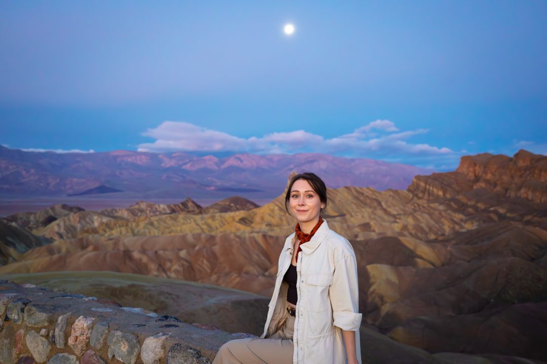
Zabriskie Point is one of Death Valley’s most famous viewpoints, overlooking the golden, eroded badlands of the Amargosa Range. The layered sedimentary rock formations here were once ancient lake beds that were carved and sculpted by wind and water into dramatic ridges and valleys.
If there’s one place in Death Valley where you absolutely must catch the sunrise, this is it. We arrived about half an hour before sunrise, and the scene was already magical. Someone even brought their golden retriever to the top. It was adorable and so happy to be surrounded by people!
The walk to the viewpoint is short, but semi-steep. It’s just a quarter mile from the parking lot on a paved path. It was quite windy and cold when we visited in winter, and lots of people were wearing beanies and down jackets, so come prepared. The payoff is worth the early wakeup call and cold weather though! The distant Panamint Mountains have a bluish tint which looks quite spectacular when the sun comes up in contrast to the closer reddish-gold badlands.
We also visited during a full moon, and watching the moon hang over the landscape as the sun rose on the opposite side was even more epic! This is easily the most stunning viewpoint in the entire park, and it’s conveniently located right off Highway 190 near Furnace Creek, making it easy to access.
Ubehebe Crater
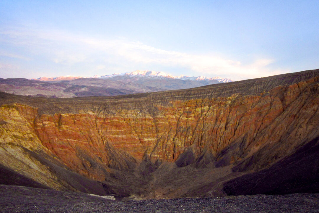
If you ever wanted to feel like you had gone to Mordor and back (without the cost of the roundtrip airfare to New Zealand), Ubehebe Crater is the spot to visit. A massive volcanic crater that was originally formed by a violent steam explosion, Ubehebe is a half a mile wide and 600 feet deep. You can easily see the dramatic crater right from the parking area, and there’s also a trail that circles the rim if you want to immerse yourself in the landscape. It’s located in the northern part of Death Valley, which is quite a bit out of the way from the main attractions (about a two hours drive from Furnace Creek), but that’s one of the reasons I’m giving it the Mordor comparison! Definitely no walk in the park, but if you have the time and want to explore one of the more unique parts of the park, Ubehebe Crater can’t be beat!
Mesquite Sand Dunes
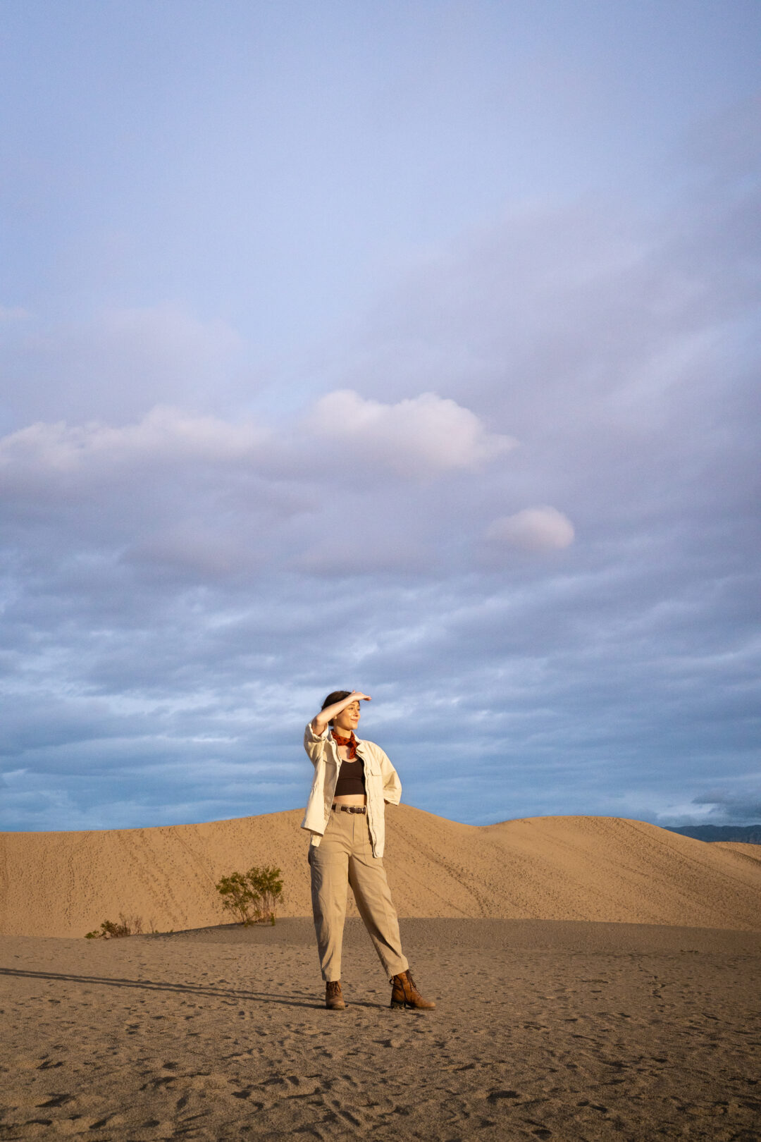
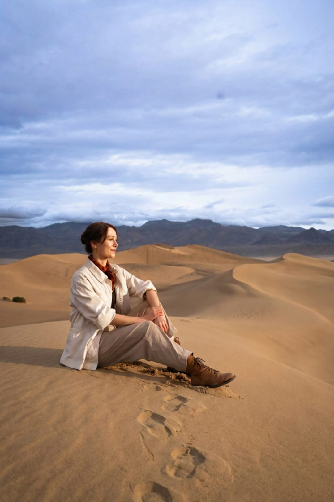
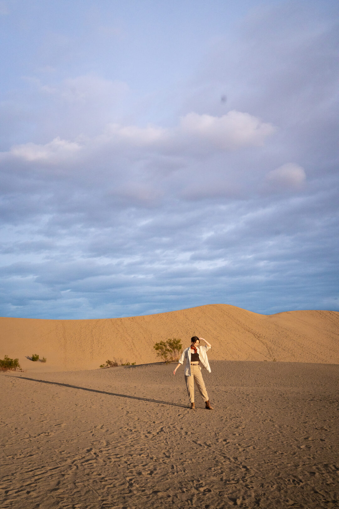
The Mesquite Flat Sand Dunes are Death Valley’s most accessible dune field, covering about 40 square miles near Stovepipe Wells. While they’re not the tallest dunes in the park (the tallest reach around 100 feet), they’re the most popular thanks to their convenient location right off the main highway and their stunning backdrop of the Amargosa Range.
These dunes are also a filming location from Star Wars, specifically the scene where R2-D2 gets stranded in the Tatooine desert. Naturally, I made some (very bad) R2-D2 noises while we were there. I may have even attempted his favorite scream!
But enough about that. It took us about half an hour to hike to one of the tallest dunes in the area, and because it had rained the day before, the sand was packed in rather than loose and shifty. This made the hike much easier than it would’ve been otherwise. On a typical dry day, you’d be sinking with every step, which is part of the challenge (and the fun!).
If you’re visiting on a dry day, consider bringing a sled to ride down one of the dunes. There’s no marked trail here, so you’re free to explore wherever you want. Early morning is your best bet if you’re looking to explore without lots of footprints already marking the sand. Plus, the early morning temperatures will make the dunes slightly more approachable than it would be during the middle of the day. Either way, Mesquite Sand Dunes is one spot that should definitely be on your Death Valley bucket list.
Mosaic Canyon
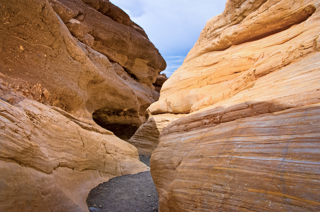
Mosaic Canyon is a narrow slot canyon known for its smooth and polished marble walls. The canyon itself gets its name from its unique “mosaic breccia” rock formations, fragments of rock naturally cemented together to create a colorful mosaic pattern. The trailhead is located about 2 miles up a gravel road from Stovepipe Wells (the road gains about 1,000 feet in elevation, so it can be a bit steep).
You won’t have to hike far into the trail to see the best features either: just a quarter mile will take you through a narrow canyon with stunning, polished rock walls. The trail continues for about 2 miles if you want to explore further, but even the short walk is worth it. For geology lovers, this is a must-see!